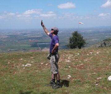
The second week of June (2016) we are on our way to central Italy, armed with a pile of Riser Magazines (Dutch paragliding & hanggliding magazine) and a paragliding app. We have 3 weeks, no fixed plans and see where the weather brings us. After a beautiful ride over the St. Bernard Pass from Switzerland into Italy we arrive in the valley of Aosta. A few years ago we found a hanggliding site where Koos eventually launched, but for now we do not see anyone flying from Andrate in front of the masts. There are also low clouds and a strong wind in the valley: we do not expect anyone in the air either. But then we see on the west side of the highway a few paragliders flying and one just lands at a full parking lot with a windsock.
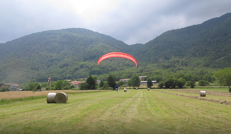
At the next exit of the autostrada we turn around and soon we find at Calea (municipality of Ivrea) a well-cared-for landing area with lots of enthusiastic Italians. Because we barely speak Italian, an English-speaking, as later appears, instructor from the local school is summoned to show us around. For 5 euros the club bus (mandatory) drives us to the lowest of the 5 launches (1300m) and a local pilot gives some tips about the area. Within 10 minutes we fly in front of the mountain with a beautiful view over the Po Valley that extends below us to the south. After the first drops of rain and lightning in the distance, we land quickly; our first holiday flight of half an hour.
The landing beer is well cooled and the atmosphere on the site is pleasant while the sun breaks through again. We can even stay overnight in the field, but the weather certain south attracts us and we drive on. A great place to start our Giro d’Italia!
Norma
Two days later we are at the launch in Norma, or rather, Norba. This is a Roman city built in 82 BC. and later completely destroyed. The remains are now slowly being exposed. Norma lies on a cliff at about 420 meters with a plain in front and a low mountain range behind it running from south-east to northwest. Two pilots have been waiting for some time: the wind is too southerly so it blows along the cliff and you would probably immediately bomb out. We decide to hang out and visit the local museum after a friendly encouragement from the lady that welcomes us in the doorway. The view from Norma is great. Fortunately, the next day we can enjoy it from the right perspective: at 1100 meters. With a small group we fly to Sermoneta. Because I miss the connection with the group, I decide to turn around, but Koos goes on a bit further. On the way back to Norma I hit big sink and have to perform a precision landing on one of the scarce pieces of grass. Next follows a long walk on the dusty and warm roads. Eventually I get a ride back up with 2 friendly locals, just in time to film Koos top landing. Although the mountain is full with paragliders waiting, only a few succeed in launching in increasing wind.
Serrone
The next day there is a storm over the middle of Italy as a result of a passing front; we even measure 97 km/h in Serrone. Serrone makes itself known as Cité de Volo libero and there are no less than 4 launches on the slopes of the mountain Scalambra. You can launch from east to west with a paraglider (and sometimes hangglider). Only not today. We stay overnight at launch 4 in a spacious parking lot with beautiful views over the valley. For us the day ends with good news: the youngest son has passed his exams!
The next morning the weather sites indicate Norma as the best option, but when we drive down the mountain to Serrone, we see a pilot on launch with his paraglider. Well, if you are there anyway … This launch is south-west oriented, at 892 m altitude and most in use. A little later there arrive 3 more pilots (who speak English, that makes communication a little easier) and half an hour later we are all hanging in front of the mountain. They had already warned us; Serrone can be turbulent and at a certain moment I get a frontstall that fortunately quickly recovers …. pfffft. Meanwhile, the thermal conditions get better and we occasionally reach a height of 1500 meters, but most of the time it’s scraping the mountain. As the landing fields are scarce in this valley flying is a bit uncomfortable under these conditions.
Because all cars are on the mountain and the rest of Italy is watching the European Championship football game against Sweden, top landing is the best option. One of the Italians makes a hard landing after several attempts, but luckily he doesn’t get injured. We, too, make an attempt but are cautious as the wind is still blowing quite strong along the mountain. The landing area (338 m) in the valley is also an interesting challenge; it consists of a large field with sheep and a tree in the middle and a smaller field that slopes slightly to the high fence that separates them. Because the wind suddenly turns in my final glide, I have to make a quick turn and stand still in front of the fence; my paraglider hanging halfway over it. Others also struggle with the field and conditions but in the end we are all safely on the ground. With a hangglider a breakchute is highly recommendable.
Poggio Bustone
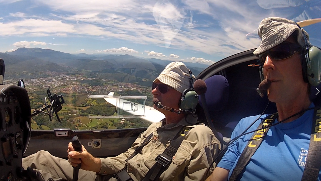
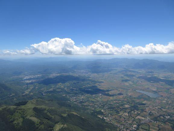
We meet with Paulo, one of the pilots with whom we have flown in Norma, the next day in Poggio Bustone, near Rieti. The landing area is very large and flat with a club house. When we arrive it is still quiet but the taxi is already full. We wait patiently while the parking lot is filling up and the locals communicate cheerfully in Italian. Then suddenly everyone is moving. Finally we end up in the taxi of Alessandro (€ 10, -). Given the horrible state of the road, a much better option then driving ourselves. The W/ZW launch (1250 m, difference in height 870 m) is fine and big enough for 20 paragliders. Soon we fly over the mountain and enjoy spicy thermals. We reach 2500m (I wish I had brought my thermal gloves) and enjoy the view over the wide valley. We do a tour of 25 km (which is a small fort his area) and cross the valley halfway. You have to pay attention for the gliders that are dragged in large numbers from Rieti. We spend the night at Agriturismo La Collina from where you can see both the landing area and the launch and can enjoy a delicious local meal.
No flying weather for two days; that means cycling around the lake of Piediluco and meeting up with a friend who has come to live here because of flying gliders. He takes us for a flight over the valley of Rieti but unfortunately the thermal conditions are moderate. In the afternoon we decide to launch from Poggio Bustone even though there is no other pilot to be found. Are we missing something? The wind is good but there is moderate uplift under the cloud cover that stretches over the mountains while my vario in the valley barely beeps.
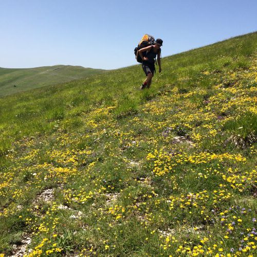
After 40 minutes I land while Koos finds something low near the mountain. I take the electric bike, which we have purchased for this purpose, with my paraglider on my back and go up the mountain. Effortlessly I cycle the first 8 km, but the backpack is very heavy and the battery get’s emptier with every turn in the road. I leave the paraglider in the bushes next to the road, but after 1 km I also have to leave the bike when the battery is completely empty…. Another 2 km walk and then I am back at the camper. After 2 hours and 15 minutes I can pick up Koos at the landing … At least I have had enough physical activity again.
Castelluccio
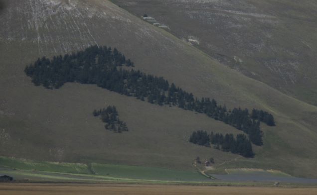
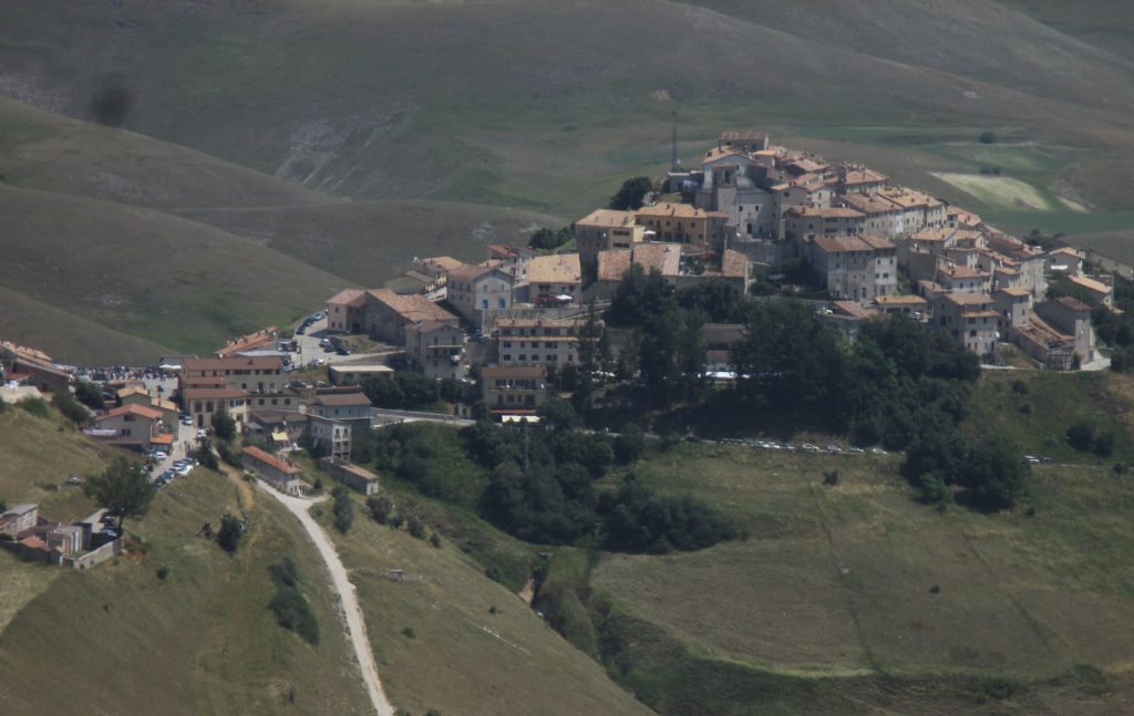
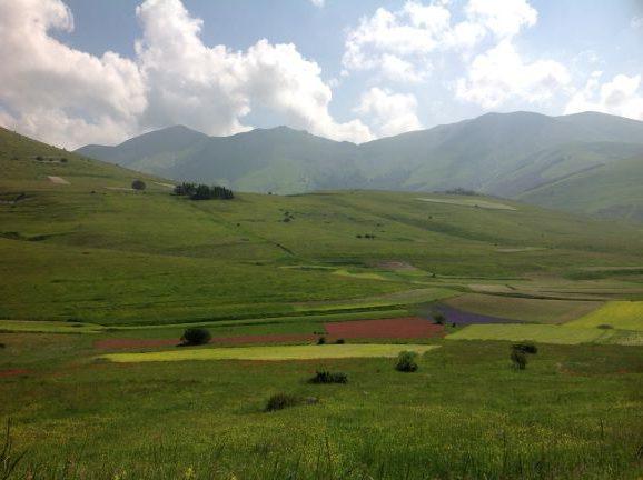
Although we have been there the year before, it remains a great experience to drive over the pass into the Castelluccio valley. Castelluccio di Norcia(*) is a small mountain village with about 150 inhabitants at 1450 m altitude in the middle of the “Pian Grande”, a vast high plateau at the foot of mountain peaks reaching up to 2500 m high. The Monte Sibellini National Park is known for the lentil fields that bloom in yellow, red, blue and green just like today.
There are 9 launches in all directions and 2 official landing fields with large windsocks. You have to register at the local flight school in the village where you immediately get a map with information about flying in the valley. Between 12.00 and 14.00 (but according to local pilots until 16.00) you have to take into account turbulence, dustdevils and other trouble when the thermals are strongest. We are here when it is unusually quiet for the season and make several beautiful flights. You can do a tour around the valley or an overland flight to the next valley if conditions are good. We camp in the designated places and in the village there are several small hotels.
On our first day here we hook up with a German school that has a number of students, who are only accustomed to stronger wind, and are ruthlessly chased of the mountain by the instructor.
We are amazed to see that these pilots do not know the proper Vorlage technique and we see exciting launches, to say the least. Some of the men are also pretty Beratungsresistenz (another word for pretty stubborn). We are amazed to see that these pilots do not know the proper Vorlage technique and we see exciting launches, to say the least. Some of the men are also pretty Beratungsresistenz (another word for pretty stubborn).
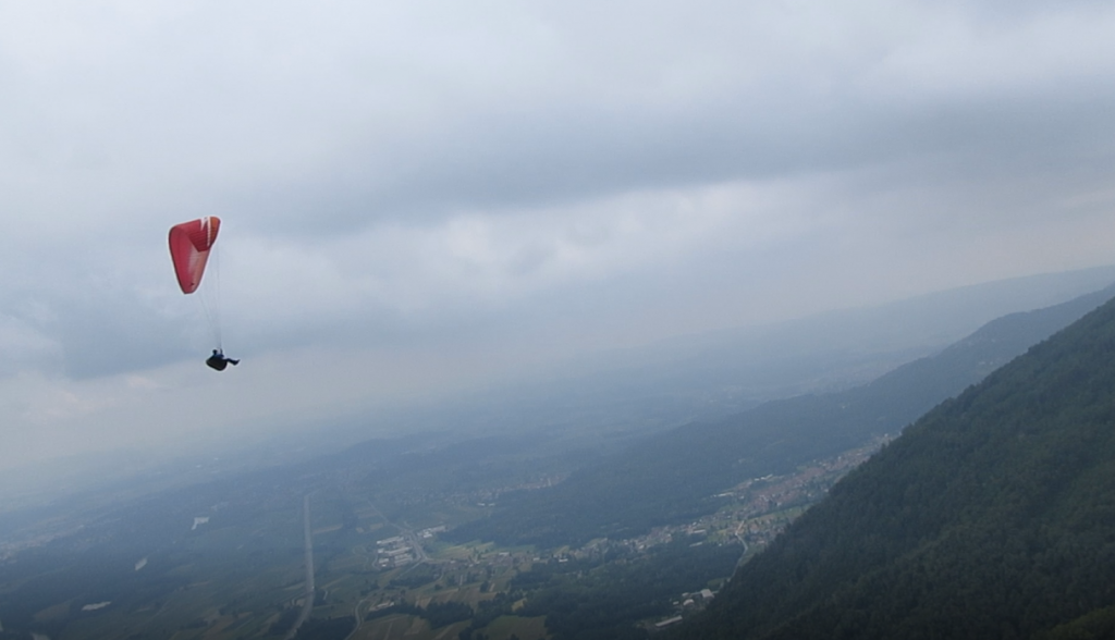
Because of the east wind we launch every day at Fontanille with 1700-1830 m (depending on your willingness to walk a bit to a random spot, because actually you can start anywhere) and thus a height difference of 380-530 m. In the fairly strong wind we it’s a bit of soaring with here and there a thermal. On the third day it goes well from 12 o’clock when the students stay on the ground. A sturdy soarwind with nice thermals and we go up to 2800 m, which offers opportunities for a valley tour. But then it over-develops and we have to land. The first rain since 20 days but after a flight of almost 3 hours you we’re not complaining.
The predictions for the next day are good, but clouds appear at an early stage. We go to Fontanille but launch conditions are weak from the south. We decide to walk to the top (250 m). When we arrive there a number of tandems are ready to go and surprisingly there is a strong west wind. The wind is decreasing, however, and at the east side of Monte Sibellini the clouds build up threateningly. And then you stand there … I launch in zero wind but soon, although there is only limited lift under the dark clouds, I pull ears to top land next to the camper. I do not trust looks of it, although you can still see the blue sky in the distance. Koos also decides to land and within 45 minutes hell breaks loose on the mountain. We park for lunch as someone knocks on the window. A wet lady askes for shelter and before we know it we are waiting for another 1.5 hours with 7 rainy Italian hikers in the camper until rain, hail, wind and thunder are over. Very cozy and this is how you make new friends! We hope to be able to make another evening flight, but there are constantly developing new thunderstorms. It’s a bit of a hassle, but you can pack a paraglider in a camper. Until late at night it remains restless with strong gusts of wind, fortunately it’s warm and cosy in the refugio Monte Vettoro.
We start the next day with a bike tour around the valley. A kind of bike & hike because there is not really a bike path on the southern part of the valley. It is a nice trip of 25 km and we are therefore warmed up for the flight. The wind has switched to the west but has also increased considerably. After a few attempts, I, like many others, pack up. Koos can launch from Forca di Presta in a very short quiet moment and quickly goes up. He makes the crossing to Monte Sibellini and even flies to Monte Prata. After 2 hours I pick him up in the valley. I make another start from Vettoretto but I can’t get up and soon have to land. I do not see myself climb up a second time and I have to do it with the memory of my beautiful flight above Monte Sibellini last year.
Monte Cucco
We drive to Monte Cucco, but there the mountain is ‘closed’ because of a model airplane competition. Monte Cucco is a beautiful mountain with 2 starting points ZW and O, and you easily topland. However, the wind has increased so much that the entire area is not flyable. Sarnone (with 6 launches and top landing possibilities oriented to the east) and Tri Pizi (Monte Gemma) at Metallica (east launch and top landing as well) are for next time. We drive north to the Dolomites and skip Bassano because of the flying crowd in this season. For some flying videos: check this out.
Feltre
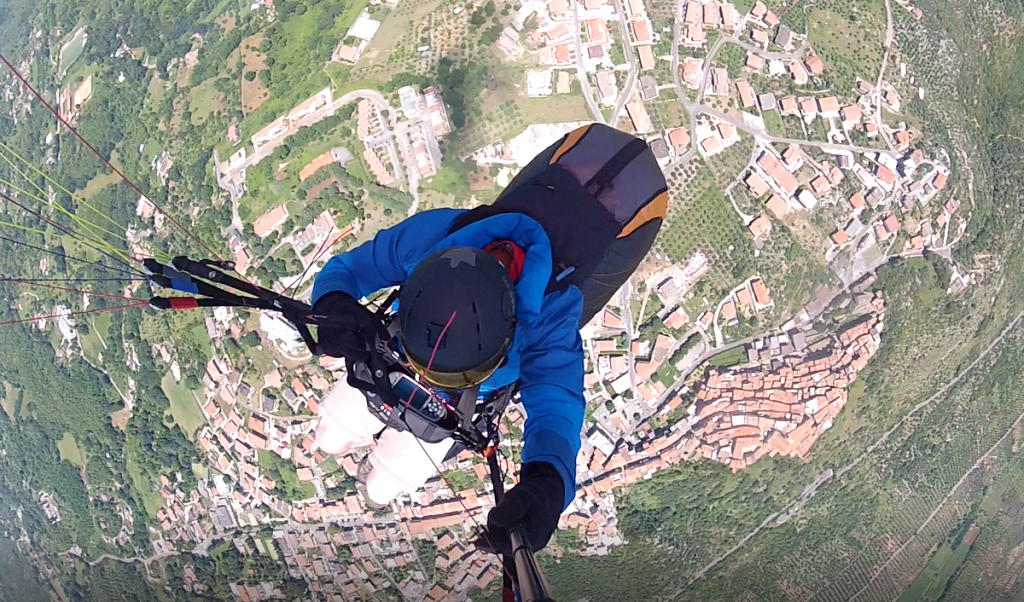
Feltre has been on Koos’ wish list for some time. We are kindly welcomed at the landing site Boscheria (just above Feltre). We register and receive 2 booklets about the do’s and don’ts (don’t fly without it) and even a beautiful map with all waypoints. In 2017 the World Cup will take place here and the big launching area can handle at least 100 pilots. There are top landing possibilities and 6 launches. The bus takes us up for € 7, – and a little later we fly at cloudbase above Monte Avena (launch 1400m). We have wind in the back to the east and with the markers in front of us we cover the first 20 km without problems. Between the clouds at 2.000m and the mountain tops you can see the characteristic peaks of the Dolomites. The valley is wide with lots of landing possibilities so we fly on for a while. Then it becomes more difficult and eventually we land after 25 km at Gron. Fortunately, we quickly have a friendly ride that brings us back to Feltre.
The next day is not the ‘Hammertag’ that was promised to us. It is too stable and we hardly get away from the mountain. It’s low searching for a thermal and the maximum height is 1750m. Above the valley I can linger a bit and see the medieval city of Feltre from above. After a good hour and a half of relaxed flying, we land.
| Name | Website |
Launch
direction | Number of launches | |
| 1 | Calea | parapendiocavallaria.jimdo.com | ZO, Z, ZW | 5 |
| 2 | Norma | Norma | ZW, W, NW | 1 |
| 3 | Serrone | vololiberoserrone.it | O, ZO, Z, ZW, W, NW | 4 |
| 4 | Poggio Bustone |
prodelta.it
ilpulcino.org | ZW, W | 2 |
| 5 | Castelluccio | prodelta.it | All directions | 9 |
| 6 | Feltre | paradeltafeltre.it | O, ZO, Z, ZW, W | 6 |
Our Italian adventure comes to an end, but our holiday ends with a nice flight in Greifenburg (Austria) that offers us a beautiful view of the Italian mountains at 2800 m.
Unfortunately Castelluccio was struck by an earthquake only 3 months after we visited this amazing place.